- Gratis verzending vanaf 30 euro
- Levert in Nederland, België etc.
- Meer dan 30.000 titels
- Vakkundige klantenservice
- Snelle levering
- Veilig en eenvoudig betalen

Direct contact?
Bel +31 (0)6 42428571
maandag t/m vrijdag
van 10 tot 17 uur
Europa / Groot-Brittannië
Groot-Brittannië bestsellers
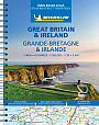
Wegenatlas Groot-Brittannië & Ierland Schotland Engeland Wales Ierland - Michelin Wegenatlassen
A4 Formaat met spiraalbinding
21,50
11,50
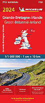
Wegenkaart - Landkaart 798 - Groot-Brittannië & Ierland - Michelin National
Water- en scheurvaste wegenkaart
12,50
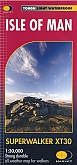
Wandelkaart Isle of Man - Walking Maps Superwalker | Harvey Maps
Water- en scheurvaste wandelkaart
23,99

|
Reisgids Britain From The Rails Bradt Travel Guide | A Window Gazer's GuideExpert railway enthusiast Ben Le Vay returns with a new edition of his much-acclaimed guide to discovering Britain from the rails. This latest edition adds new lines and destinations in Britain's fast-changing railway, while updating the guide to the classic greats. Thoroughly updated, it includes a full, fascinating guide to the new Borders Railway in Scotland, plus details of the new route from London to Oxford and expanded coverage of the eccentric Jolly Fisherman line in Lincolnshire and the charming Cotswold line from Oxford to Hereford. Also included are more... |
21,99 Tijdelijk niet leverbaar |
|
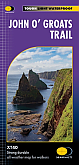
Wandelkaart John O'Groats Trail | Harvey Maps | Water- en scheurvaste wandelkaartDe Harvey Map is de wandelkaart voor het wandelen in de mooiste natuurgebieden in het Groot-Brittannië. Duidelijke topografische wandelkaarten met praktische informatie van de route zoals overnachtingsmogelijkheden, eetgelegenheden en bezienswaardigheden. Deze wandelkaart is scheur- en watervast. The John o' Groats Trail is a 237 km (147 miles) coastal walking route from Inverness to John o' Groats, traversing shorelines, cliff tops, back lanes and footpaths. The walk includes some of the most dramatic scenery in Britain, with sea arches, sea stacks and hidden natural... Schaal: 1:40.000 |
25,99 |

|
Reisgids Edinburgh ANWB Extra | De kompakte reisgids met uitneembare kaartMet de ANWB Extra gids hebt u een handzame reisgezel. In de gids staat actuele informatie over bezienswaardigheden, café's, hotels, de lokale keuken, winkelen en uitgaan. De ANWB heeft een tiental hoogtepunten geselecteerd voor als u snel de leukste plekjes of mooiste bezienswaardigheden wilt vinden. De handige uitneembare kaart is een grote plus bij deze compacte gids. Ideaal voor een de reiziger die een korte vakantie neemt of die tijdens een uitrustvakantie toch nog wat cultuur en natuur wil zien. |
15,50 |

|
Reisgids Londen ANWB Extra | De kompakte reisgids met uitneembare kaartMet de ANWB Extra gids hebt u een handzame reisgezel. In de gids staat actuele informatie over bezienswaardigheden, café's, hotels, de lokale keuken, winkelen en uitgaan. De ANWB heeft een tiental hoogtepunten geselecteerd voor als u snel de leukste plekjes of mooiste bezienswaardigheden wilt vinden. De handige uitneembare kaart is een grote plus bij deze compacte gids. Ideaal voor een de reiziger die een korte vakantie neemt of die tijdens een uitrustvakantie toch nog wat cultuur en natuur wil zien. ANWB Extra reisgids Londen - Groot-Brittannië |
15,50 |
|
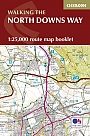
Wandelkaartgids The North Downs Way Booklet | Cicerone | National trail from Farnham to DoverHandzaam kaartgidsje. Gedetailleerde topografische wandelkaarten gebonden in een handig boekje. Licht voor onderweg. Map of the 130 mile (208km) North Downs Way National Trail, between Farnham and Dover, including an optional visit to Canterbury. This booklet is included with the Cicerone guidebook to the trail and shows the full route on OS 1:25,000 maps. One of the easier National Trails, it can be comfortably walked in 11-12 days. Schaal: 1:25.000 |
13,99 Tijdelijk niet leverbaar |
|
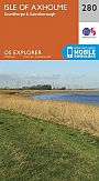
Topografische Wandelkaart 280 Isle of Axholme Scunthorpe & Gainsborough - Explorer Map | Wandelkaart & Fietskaart | Ordnance Survey (OS) Groot-BrittanniëDeze gedetailleerde en informatieve topografische kaart (stafkaart, schaal 1:25.000) van Groot-Brittannië bevat alle topografische elementen van het landschap en geeft daarmee een nauwkeurig beeld van het terrein. Daarnaast heeft Ordnance Survey (OS) ook toeristische informatie op de meeste kaart verwerkt, zoals de aanduiding voor campings en ingetekende wandelpaden . Deze kaart is ideaal voor wandelaars of fietsers, maar ook voor de scouting of sportverenigingen die activiteiten in Groot-Brittannië gaan uitvoeren. De kaarten zijn voorzien van een GPS aanduiding en e... Schaal: 1:25.000 |
18,99 Tijdelijk niet leverbaar |
|
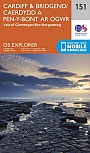
Topografische Wandelkaart 151 Cardiff / Bridgend Vale of Glamorgan - Explorer Map | Wandelkaart & Fietskaart | Ordnance Survey (OS) Groot-BrittanniëDeze gedetailleerde en informatieve topografische kaart (stafkaart, schaal 1:25.000) van Groot-Brittannië bevat alle topografische elementen van het landschap en geeft daarmee een nauwkeurig beeld van het terrein. Daarnaast heeft Ordnance Survey (OS) ook toeristische informatie op de meeste kaart verwerkt, zoals de aanduiding voor campings en ingetekende wandelpaden . Deze kaart is ideaal voor wandelaars of fietsers, maar ook voor de scouting of sportverenigingen die activiteiten in Groot-Brittannië gaan uitvoeren. De kaarten zijn voorzien van een GPS aanduiding en e... Schaal: 1:25.000 |
18,99 |
|
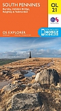
Topografische Wandelkaart OL21 van Groot-Brittannië (1:25.000) South Pennines - Explorer Map OL 21 | Wandelkaart | Ordnance Survey (OS) Groot-BrittanniëDeze gedetailleerde en informatieve topografische kaart (stafkaart, schaal 1:25.000) van Groot-Brittannie bevat alle topografische elementen van het landschap en geeft daarmee een nauwkeurig beeld van het terrein. Daarnaast heeft Ordnance Survey (OS) ook toeristische informatie op de meeste kaart verwerkt, zoals de aanduiding voor campings en ingetekende wandelpaden . Deze kaart is ideaal voor wandelaars of fietsers, maar ook voor de scouting of sportverenigingen die activiteiten in Groot-Brittanni« gaan uitvoeren. De kaarten zijn voorzien van een GPS aanduiding en ... Schaal: 1:25.000 |
18,99 |
|
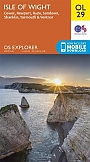
Topografische Wandelkaart OL29 van Groot-Brittannië (1:25.000) Isle of Wight - Explorer Map OL 29 | Wandelkaart | Ordnance Survey (OS) Groot-BrittanniëDeze gedetailleerde en informatieve topografische kaart (stafkaart, schaal 1:25.000) van Groot-Brittannië bevat alle topografische elementen van het landschap en geeft daarmee een nauwkeurig beeld van het terrein. Daarnaast heeft Ordnance Survey (OS) ook toeristische informatie op de meeste kaart verwerkt, zoals de aanduiding voor campings en ingetekende wandelpaden . Deze kaart is ideaal voor wandelaars of fietsers, maar ook voor de scouting of sportverenigingen die activiteiten in Groot-Brittannië gaan uitvoeren. De kaarten zijn voorzien van een GPS aanduiding en e... Schaal: 1:25.000 |
18,99 |
|
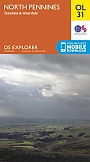
Topografische Wandelkaart OL31 van Groot-Brittannië (1:25.000) North Pennines / Teesdale / Weardale - Explorer Map OL 31 | Wandelkaart | Ordnance Survey (OS) Groot-BrittanniëDeze gedetailleerde en informatieve topografische kaart (stafkaart, schaal 1:25.000) van Groot-Brittannië bevat alle topografische elementen van het landschap en geeft daarmee een nauwkeurig beeld van het terrein. Daarnaast heeft Ordnance Survey (OS) ook toeristische informatie op de meeste kaart verwerkt, zoals de aanduiding voor campings en ingetekende wandelpaden . Deze kaart is ideaal voor wandelaars of fietsers, maar ook voor de scouting of sportverenigingen die activiteiten in Groot-Brittannië gaan uitvoeren. De kaarten zijn voorzien van een GPS aanduiding en e... Schaal: 1:25.000 |
18,99 |
|
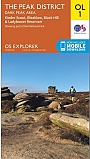
Topografische Wandelkaart OL1 van Groot-Brittannië (1:25.000) Peak District - Dark Peak area - Explorer Map OL 1 | Wandelkaart | Ordnance Survey (OS) Groot-BrittanniëDeze gedetailleerde en informatieve topografische kaart (stafkaart, schaal 1:25.000) van Groot-Brittannië bevat alle topografische elementen van het landschap en geeft daarmee een nauwkeurig beeld van het terrein. Daarnaast heeft Ordnance Survey (OS) ook toeristische informatie op de meeste kaart verwerkt, zoals de aanduiding voor campings en ingetekende wandelpaden . Deze kaart is ideaal voor wandelaars of fietsers, maar ook voor de scouting of sportverenigingen die activiteiten in Groot-Brittannië gaan uitvoeren. De kaarten zijn voorzien van een GPS aanduid... Schaal: 1:25.000 |
18,99 |
|
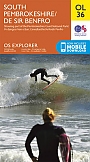
Topografische Wandelkaart OL36van Groot-Brittannië (1:25.000) Pembrokeshire South / De Sir Benfro - Explorer Map OL 36 | Wandelkaart | Ordnance Survey (OS) Groot-BrittanniëDeze gedetailleerde en informatieve topografische kaart (stafkaart, schaal 1:25.000) van Groot-Brittannië bevat alle topografische elementen van het landschap en geeft daarmee een nauwkeurig beeld van het terrein. Daarnaast heeft Ordnance Survey (OS) ook toeristische informatie op de meeste kaart verwerkt, zoals de aanduiding voor campings en ingetekende wandelpaden . Deze kaart is ideaal voor wandelaars of fietsers, maar ook voor de scouting of sportverenigingen die activiteiten in Groot-Brittannië gaan uitvoeren. De kaarten zijn voorzien van een GPS aanduiding en e... Schaal: 1:25.000 |
18,99 |
|
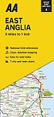
Wegenkaart - Landkaart 4 East Anglia - AA Road Map BritainOverzichtelijke wegenkaarten met een helder kaartbeeld. Wegnummers zijn weergegeven. Toerististische informatie door middel van pictogrammen. Campings, VVV, musea, grotten, picnic plekken, kastelen zijn onder andere aangegeven. Op de achterzijde staat een plaatsnamen register plus een aantal stadsplattegrondjes. Schaal: 1:200.000 |
8,99 |
|
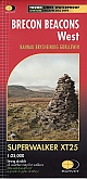
Wandelkaart Brecon Beacons West - Walking Maps Superwalker | Harvey Maps | Water- en scheurvaste wandelkaartDe Harvey Map is de wandelkaart voor het wandelen in de mooiste natuurgebieden in het Groot-Brittannië. Duidelijke topografische wandelkaarten met praktische informatie van de route zoals overnachtingsmogelijkheden, eetgelegenheden en bezienswaardigheden. Deze wandelkaart is scheur- en watervast. Met GPS compatible (UTM-Grid). The Brecon Beacons West map for walkers covers Brynamman to Ystradfellte. Schaal: 1:25.000 |
25,99 |
|
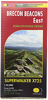
Wandelkaart Brecon Beacons East - Walking Maps Superwalker | Harvey Maps | Water- en scheurvaste wandelkaartDe Harvey Map is de wandelkaart voor het wandelen in de mooiste natuurgebieden in het Groot-Brittannië. Duidelijke topografische wandelkaarten met praktische informatie van de route zoals overnachtingsmogelijkheden, eetgelegenheden en bezienswaardigheden. Deze wandelkaart is scheur- en watervast. Met GPS compatible (UTM-Grid). Brecon Beacons East map for hillwalkers covers Ystradfellte to Llangynidr. Schaal: 1:25.000 |
24,95 |

|
Wandelkaart Pennine Way North: Greenhead to Kirk Yetholm - National Trail Maps | Harvey Maps | Water- en scheurvaste wandelkaartDe Harvey Map is de wandelkaart voor het lange afstand wandelpad in het Groot-Brittannië. Duidelijke topografische wandelkaarten met praktische informatie van de route zoals overnachtingsmogelijkheden, eetgelegenheden en bezienswaardigheden. Deze wandelkaart is scheur- en watervast. Met GPS compatible (UTM-Grid). The Pennine Way is a National Trail. It follows the backbone of England from the Peak District to the Scottish borders. It is one of the toughest UK long distance footpaths, and forms part of the European Footpath Network. Schaal: 1:40.000 |
25,99 |
|
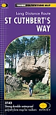
Wandelkaart St. Cuthbert's Way - National Trail Maps | Harvey Maps | Water- en scheurvaste wandelkaartDe Harvey Map is de wandelkaart voor het lange afstand wandelpad in het Groot-Brittannië. Duidelijke topografische wandelkaarten met praktische informatie van de route zoals overnachtingsmogelijkheden, eetgelegenheden en bezienswaardigheden. Deze wandelkaart is scheur- en watervast. Met GPS compatible (UTM-Grid). Schaal: 1:40.000 |
25,99 |

|
Wandelkaart Ridgeway - National Trail Maps | Harvey Maps | Water- en scheurvaste wandelkaartDe Harvey Map is de wandelkaart voor het lange afstand wandelpad in het Groot-Brittannië. Duidelijke topografische wandelkaarten met praktische informatie van de route zoals overnachtingsmogelijkheden, eetgelegenheden en bezienswaardigheden. Deze wandelkaart is scheur- en watervast. Met GPS compatible (UTM-Grid). Compact and light - the map itself weighs just 60gms - a third of the weight of a laminated map, and much less bulky. And you can fold or refold it time and again, or stuff it in your back pocket and it won't fall to pieces. Schaal: 1:40.000 |
25,99 |

|
Wandelkaart Dark Peak - Walking Maps Superwalker | Harvey Maps | Water- en scheurvaste wandelkaartDe Harvey Map is de wandelkaart voor het wandelen in de mooiste natuurgebieden in het Groot-Brittannië. Duidelijke topografische wandelkaarten met praktische informatie van de route zoals overnachtingsmogelijkheden, eetgelegenheden en bezienswaardigheden. Deze wandelkaart is scheur- en watervast. Met GPS compatible (UTM-Grid). Detailed map for walking, scrambling and climbing Schaal: 1:25.000 |
17,99 |
|
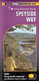
Wandelkaart Speyside Way - National Trail Maps | Harvey Maps | Water- en scheurvaste wandelkaartDe Harvey Map is de wandelkaart voor het lange afstand wandelpad in het Groot-Brittannië. Duidelijke topografische wandelkaarten met praktische informatie van de route zoals overnachtingsmogelijkheden, eetgelegenheden en bezienswaardigheden. Deze wandelkaart is scheur- en watervast. Met GPS compatible (UTM-Grid). A leap forward in technical excellence: Tough, durable and 100% waterproof - virtually indestructible in normal use. Schaal: 1:40.000 |
25,99 |
|
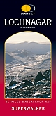
Wandelkaart Lochnagar and Glen Shee - Walking Maps Superwalker | Harvey Maps | Water- en scheurvaste wandelkaartDe Harvey Map is de wandelkaart voor het wandelen in de mooiste natuurgebieden in het Groot-Brittannië. Duidelijke topografische wandelkaarten met praktische informatie van de route zoals overnachtingsmogelijkheden, eetgelegenheden en bezienswaardigheden. Deze wandelkaart is scheur- en watervast. Met GPS compatible (UTM-Grid). Superb walking area south of Braemar with 3 Corbetts and 17 Munros. This map for hillwalkers covers Lochnagar itself. The sheet extends 6km west from the A93 and the Glen Shee ski centre car park and 16km east to Glen Muick and Glen Doll. Schaal: 1:25.000 |
17,99 |
|
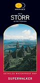
Wandelkaart Skye Storr and Trotternish - Walking Maps Superwalker | Harvey Maps | Water- en scheurvaste wandelkaartDe Harvey Map is de wandelkaart voor het wandelen in de mooiste natuurgebieden in het Groot-Brittannië. Duidelijke topografische wandelkaarten met praktische informatie van de route zoals overnachtingsmogelijkheden, eetgelegenheden en bezienswaardigheden. Deze wandelkaart is scheur- en watervast. Met GPS compatible (UTM-Grid). Schaal: 1:25.000 |
17,99 |
|
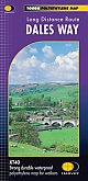
Wandelkaart Dales Way - National Trail Maps | Harvey Maps | Water- en scheurvaste wandelkaartDe Harvey Map is de wandelkaart voor het lange afstand wandelpad in het Groot-Brittannië. Duidelijke topografische wandelkaarten met praktische informatie van de route zoals overnachtingsmogelijkheden, eetgelegenheden en bezienswaardigheden. Deze wandelkaart is scheur- en watervast. Met GPS compatible (UTM-Grid). Compact and light - the map itself weighs just 60gms - a third of the weight of a bulky laminated map. You can fold or refold it time and again, or stuff it in your back pocket and it won't fall to pieces. Schaal: 1:40.000 |
25,99 |
|
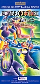
Fietskaart Pembrokeshire West Wales cycling map | GoldeneyeDe Goldeneye kaarten zijn uitstekende vrijetijdskaarten voor Groot-Brittannië, met name goed te gebruiken voor het fietsen door de overzichtelijke schaal. De De kaarten zijn helder, overzichtelijk en gedrukt op stevig papier. De MapGuide-kaarten bevatten toeristische informatie op de achterzijde van de kaart. De CyclingMaps bevatten fietspaden die over het algemeen vrij liggen van drukke wegen en/of gemotoriseerd verkeer en daarnaast ook de fietspaden van NCN (De Britse 'National Cycle Network'). Een handig register met plaatsnamen maakt het eenvoudig om p... Schaal: 1:126.720 |
10,99 |
|
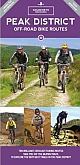
Mountainbikekaart Peak District MTB map | GoldeneyeDe Goldeneye kaarten zijn uitstekende vrijetijdskaarten voor Groot-Brittannië, met name goed te gebruiken voor het fietsen door de overzichtelijke schaal. De De kaarten zijn helder, overzichtelijk en gedrukt op stevig papier. Deze Mountainbikekaarten zijn uniek voor Groot-Brittannië en bevatten paden die vrij liggen van drukke wegen en/of gemotoriseerd verkeer. Daarnaast bevat het ook ook de fietspaden van NCN (De Britse 'National Cycle Network') en andere fietspaden om je route vanuit een bepaald punt aan te kunnen fietsen. Een handig register met pl... Schaal: 1:37.700 |
12,50 |
|
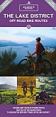
Mountainbikekaart Lake District MTB map | GoldeneyeDe Goldeneye kaarten zijn uitstekende vrijetijdskaarten voor Groot-Brittannië, met name goed te gebruiken voor het fietsen door de overzichtelijke schaal. De De kaarten zijn helder, overzichtelijk en gedrukt op stevig papier. Deze Mountainbikekaarten zijn uniek voor Groot-Brittannië en bevatten paden die vrij liggen van drukke wegen en/of gemotoriseerd verkeer. Daarnaast bevat het ook ook de fietspaden van NCN (De Britse 'National Cycle Network') en andere fietspaden om je route vanuit een bepaald punt aan te kunnen fietsen. Een handig register met pl... Schaal: 1:37.700 |
12,50 |

|
Fietskaart Oban to Campbeltown NN78 Cycle Map | SustransSustrans kaarten geven een goed overzicht van het National Cycle Network. 25.000 km lang is het fietsnetwerk inmiddels. De routes zijn bewegwijzerd, autoluw en fietsvriendelijk. Oude spoorwegen zijn omgetoverd in fietspaden of er wordt gebruik gemaakt van jaagpaden langs waterwegen. De cartografie is duidelijk met veel praktische informatie. Sustrans' Official Route Map and Information on the 121 Miles of National Cycle Network from Oban to Campbeltown in Western Scotland. Schaal: 1:100.000 |
10,99 |

|
Fietskaart Wales Celtic Trail East Cycle NN4B Map | Sustrans | Chepstow - Swansea, Cardiff - Brecon and other routesSustrans kaarten geven een goed overzicht van het National Cycle Network. 25.000 km lang is het fietsnetwerk inmiddels. De routes zijn bewegwijzerd, autoluw en fietsvriendelijk. Oude spoorwegen zijn omgetoverd in fietspaden of er wordt gebruik gemaakt van jaagpaden langs waterwegen. De cartografie is duidelijk met veel praktische informatie. Schaal: 1:100.000 |
10,99 |
|
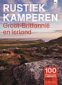
Campinggids Groot-Brittannië en Ierland Rustiek Kamperen | Blu | 100 kleine campings en rustige campingsDe serie Rustiek Kamperen heeft in de afgelopen twintig jaar een grote schare liefhebbers van natuurlijk en kleinschalig kamperen opgebouwd. Met deze geheel nieuwe gids heb je de beste selectie van rustieke campings in Groot-Brittannië en Ierland nu bij de hand. De belangstelling om te kamperen in Engeland, Wales, Schotland en Ierland is groot. Prachtige diepgroene land- schappen, veel bloemen, indrukwekkende kusten en ruige bergmeren worden afgewisseld door oude stadjes, mooie kastelen en gezellige pubs. Hier kamperen hoeft echt niet op een massaal terrein vol me... |
15,95 |
|
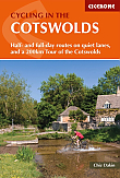
Fietsgids Cotswold Cycling in the Cotswolds | Cicerone | Half- and full day routes and a 200 km tour of the CotswoldsPacked with routes right across the Cotswolds Area of Outstanding Natural Beauty, this guidebook is all you need to explore the lanes and tracks of this much-loved area on two wheels - off-road on your mountain bike or on-road on your road bike or a bit of both on hybrid/sturdy bike (most routes have an on-road alternative). 21 day routes ranging from 9 to 41 miles are included, illustrated with clear custom-drawn maps and profiles, as well as a 4-day 200km tour which takes in all the Cotswolds' best highlights. Routes are arranged by difficulty, ranging from easy,... |
17,99 |
|
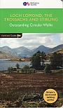
Wandelgids 23 Loch Lomond, The Trossachs and Stirling Pathfinder Guide | Pathfinder Guide 23 | Met Ordanance Survey kaartenDeze Pathfinder Guide is een goed uitgevoerde gids met verschillende wandelingen in Groot-Britannië. De gids bevat naast goede topografische kaarten van de Britse topografische dienst (Ordanance Survey) ook beschrijvingen van het landschap, de cultuur en/of de flora en fauna. Verder is de gids voorzien van praktische informatie zoals startpunten, verwachte wandeltijd, restaurants en cafés voor onderweg. Walking in Scotland is quite different from walking south of the border. In England there are only eight summits that top 3000 ft, while in Scotland there a... |
17,99 |
|
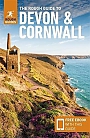
Reisgids Devon & Cornwall Rough GuideDe Rough Guide is een zeer degelijke, uitgebreide en informatieve reisgids voor iedere type reiziger: van backpacker tot cultuurreiziger. De Rough Guide staat bekend om de degelijke en goed onderzochte achtergrondinformatie en de goede ordening van verschillende onderwerpen. Voor veel gebieden is de Rough Guide een goed, soms zelfs een beter, alternatief voor de populaire Lonely Planet. Taking you to the historic cities of Devon and Cornwall, this Rough Guide shows you the galleries of St. Ives and local donkey sanctuaries in this updated guide, the ideal companion whe... |
18,99 Tijdelijk niet leverbaar |
|
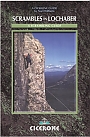
Klimgids Scrambles in Lochaber Cicerone Guidebooks | A guide to scrambles in and around Lochaber including Ben NevisThis guide describes some of the best scrambles to be found within a 45km radius of the town of Fort William, an area which includes not only Ben Nevis and Glen Coe, but also Ben Alder to the east, Ben Cruachan to the south, Garbh Bheinn to the west and The Saddle to the north. Most of this area falls within the Lochaber Area of the Highland Council. It is the most popular area in the whole of Scotland with hillgoers, and justifiably so, for it contains some of the most varied and spectacular mountain scenery in the Highlands. The guide contains over seventy routes in ... |
17,99 Tijdelijk niet leverbaar |

|
Wandelgids Hadrian's Wall Path Cicerone Guidebooks | National Trail Two-way national trail descriptionThe essential guidebook to walking the 84-mile Hadrian"s Wall Path. One of the UK's most visited National Trails, it runs the length of the Roman Wall from Bowness-on-Solway in Cumbria to Wallsend, Newcastle. Schaal: 1:25.000 |
22,99 |
|
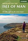
Wandelgids The Isle of Man Cicerone Guidebooks | 40 walks exploring the entire islandThis guidebook contains 40 walking routes on the Isle of Man. The routes range from 2 to 22km and cover diverse landscape from open moorland and wooded glens to beaches and bare mountain tops, all with OS maps. The emphasis is on short, easy to access walks but it is possible to join routes together for a longer trail. |
18,99 |
|
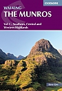
Wandelgids Walking the Munros Southern, Central and Western Highlands Volume 1 Cicerone GuidebooksHalf of a two-volume set describing challenging and inspiring routes to climb Scotland's 282 3000ft+ mountains, this guide covers the southern, central and western Highlands (south of the Great Glen), taking in stunning areas such as Glen Coe, Glen Shee, Lochaber and Mull. |
18,99 |

|
Wandelgids The North York Moors Cicerone Guidebooks | 50 walks throughout the National ParkThis guidebook offers 50 walks in seven regions throughout the North York Moors National Park, enabling walkers to discover and appreciate in turn the Tabular Hills, Hambleton Hills, Cleveland Hills, Northern Moors, High Moors, Eastern Moors and Cleveland Coast. For those walkers who like to rise to a challenge, the course of the classic Lyke Wake Walk is also offered, split over a four-day period to allow a more leisurely appreciation of the moors as it stretches across the national park from east to west. There are almost 750km (465 miles) of walking routes described... |
16,99 |

|
Wandelgids The Ribble Way Cicerone Guidebooks | A one-week walk across Lancashire into Yorkshire from Preston to the source
|
22,99 |
|
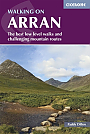
Wandelgids Walking on the Isle of Arran Cicerone Guidebooks | The best low level walks and challenging mountain routes, including the Arran Coastal WayThe 45 walking routes in this Isle of Arran guidebook range from easy 3km (2 miles) nature trails to long arduous mountain routes with scrambles (up to 32km) providing thorough coverage of Arran, including the ascent of Goatfell and nearby Holy Isle. Most routes are 10km to 15km long but many give opportunities to create longer cross island walks. This guidebook presents a selection of 45 day walks on the popular and accessible Isle of Arran. The routes are between 2 miles (3km) and 20 miles (32km) in length, from easy waymarked forest trails to more arduous mountain w... |
23,95 |
|
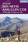
Wandelgids Ben Nevis and Glen Coe Cicerone Guidebooks | A Walking GuidebookGuidebook to walking in Scotland's Ben Nevis and Glen Coe region, featuring 100 graded walks of 2 to 21 miles. Routes include low-level, mid-level and high-level walks, with the high-level walks showcasing 44 Munro summits. Routes are organised by location, being in and around: Fort William and Glen Nevis; Ben Nevis and the Aonachs; Grey Corries and Spean Bridge; Mamores; Kinlochleven; Glen Coe; Bidean nam Bian; and Glen Etive. Home to some of the finest walking in the UK, the Ben Nevis and Glen Coe region offers the thrill of summiting many a Munro, as well innumerabl... |
19,99 |
|
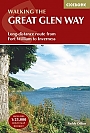
Wandelgids The Great Glen Way Cicerone Guidebooks | Two Way Trail guide
|
19,99 |

|
Wandelgids Coast to Coast Walk Cicerone Guidebooks | From St Bees Head in Cumbria to Robin Hood’s Bay on Yorkshire’sFirst devised by Alfred Wainwright, the Coast to Coast Walk has emerged as a favourite among long-distance walkers. The route stretches some 185 miles (296km) from St Bees, an historic seaside village on Cumbria's west coast to Robin Hood's Bay in North Yorkshire. It is suitable for most fit walkers and can be comfortably walked in around a fortnight. This guidebook presents the full route from west to east in 13 stages of 10 ½-20 ¾ miles (16.8-33.2km), with summaries covering the opposite direction. Alongside step-by-step route description... |
22,99 |

|
Wandelgids East White Peak Walks: Peak District Cicerone GuidebooksThis guidebook provides 35 day walks and 7 longer walks and trails exploring the eastern section of Derbyshire's limestone area. The walks are spread across the area, starting in pleasant towns and villages including Bakewell, Tissington, Eyam and Middleton. Largely travelling along well-marked paths over gentle rolling landscapes, these walks are suitable for walkers of all abilities. The day walks range between 4 and 12 miles in length, and are illustrated with extracts of 1:50,000 OS mapping, while the longer walks and trails are covered by 1:100,000 scal... |
16,99 |
|
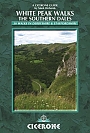
Wandelgids White Peak Walks: The Southern Dales Cicerone Guidebooks | 30 walks in Derbyshire and StaffordshireMark Richards' guide to walking the southern dales of the White Peak area of the Peak District, England UK, between Ashbourne, Matlock, Buxton and Leek. 30 easy circular routes cross the high plateau and follow the Dove, Manifold and Hamps rivers through the dales in the UK's first National Park. |
17,99 |
|
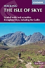
Wandelgids The Isle of Skye Cicerone Guidebooks | Graded walks and scrambles throughout Skye, including the CuillinThis third edition of Terry Marsh"s walking and scrambling guide to Skye, the Hebrides, northwest Scotland, updated using digital mapping and GPS. 87 walks and scrambles in Sleat and South-East Skye, Strath, Minginish, Duirinish, Waternish and Trotternish for all abilities. Each route describes local historical and geological points of interest. The fame of Skye, the most scenically awe-inspiring of Scotland's many islands, is widespread; you either love it, or hate it. There is no neutrality. For walkers and climbers this is the Promised Land, a place of raw ... |
19,99 |
|
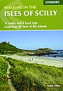
Wandelgids Walking in the Isles of Scilly Cicerone Guidebooks | 11 walks and 4 boat trips exploring the best of the islandsThis guidebook to walking on the Scilly Isles at the south-western edge of Britain includes 11 day walks and 4 boat trips, perfect for a fortnight away from it all. The walks are between 2 and 16km long, and explore the larger islands such as Tresco, St Martin's, St Mary's, St Agnes and Bryher as well as smaller islands in the archipelago. Alongside the walks, which are suitable for walkers of all abilities, are 4 Boat Trips which explore Annet and the Western Rocks, the Norrard Rocks, St Helens and Teän as well as the Eastern Isles. With their m... |
12,99 |
|
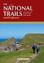
The National Trails Complete Guide to Britain's National Trails | CiceroneThis inspirational guidebook looks at each of the UK's 19 National Trails, with information that allows ease of comparison and contrast, inspiring you to find out more and to take up a long-distance challenge. Some Trails are short and easy, others much longer, many have strong themes - they may follow a coastline, or traverse ranges of hills. All trails can be tackled throughout the year, though many of the northern and Scottish routes can be challenging in winter conditions. Avoid the Hadrian's Wall Path in winter, as the ground is soft and underlying archaeo... |
25,99 |
|
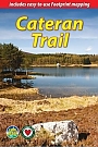
Wandelgids Cateran Trail Rucksack ReadersRucksack Readers zijn handig uitgevoerd in een klapper met ringband. Deze gids heeft een goede beschrijving van de lange afstands route met overzichtelijke kaarten doch zonder veel detail. De kracht van de Rucksack Readers is de uitgebreide achtergrondinformatie over de flora, fauna en geologische verschijnselen. Dit alles rijkelijk omkleed met kleurrijke foto's en praktische tips. The Cateran Trail is one of Scotland’s Great Trails – a circular walk of 64 miles (104 km) starting in Blairgowrie, near Perth, following in the footsteps of cattle-rustlers ... |
18,95 |
|
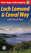
Wandelgids Loch Lomond and The Cowal Way with Isle of Bute Rucksack Readers | Waterproof met spiraalbindingDeze gids heeft een goede beschrijving van de lange afstands route met overzichtelijke kaarten doch zonder veel detail. De kracht van de Rucksack Readers is de uitgebreide achtergrondinformatie over de flora, fauna en geologische verschijnselen. Dit alles rijkelijk omkleed met kleurrijke foto's en praktische tips. Waterproof met spiraalbinding. The Cowal Way runs for 57 miles (92 km) across the Cowal peninsula, which lies west of Glasgow and has ferry links with the Isle of Bute. The route starts at Portavadie on Loch Fyne and ends at Inveruglas on Loch Lomond. The... |
19,90 |

|
Wandelgids Coast to Coast Rucksack ReadersRucksack Readers zijn handig uitgevoerd in een klapper met ringband. Deze gids heeft een goede beschrijving van de lange afstands route met overzichtelijke kaarten doch zonder veel detail. De kracht van de Rucksack Readers is de uitgebreide achtergrondinformatie over de flora, fauna en geologische verschijnselen. Dit alles rijkelijk omkleed met kleurrijke foto's en praktische tips. |
21,99 |