- Gratis verzending vanaf 30 euro
- Levert in Nederland, België etc.
- Meer dan 30.000 titels
- Vakkundige klantenservice
- Snelle levering
- Veilig en eenvoudig betalen

Direct contact?
Bel +31 (0)6 42428571
maandag t/m vrijdag
van 10 tot 17 uur
Wandelgids Walking in Torridon Fisherfield Fannichs and An Teallach Cicerone Guidebooks
Including the ridges of Beinn Alligin, Liathach and Beinn Eighe

Guide to 50 walks and easy scrambles in north-western Scotland, covering Southern Torridon, Northern Torridon, Letterewe and Fisherfield, and the Fannichs. Ascents of 27 Munros, 20 Corbetts and 14 Grahams are included, with highlights including Liathach, Beinn Eighe, Beinn Alligin, An Teallach and Slioch. The walks are suitable for those with good navigation skills who are competent in a mountain environment.
All the walks in the guide are graded, with summary statistics provided, and each includes clear route description and mapping. There's also a route summary table to help with choosing appropriate walks. Background information on local geology, wildlife and history, and planning details on when to go, where to stay and what to take are included to make the most out of any trip to Torridon.
The region boasts spectacular and distinctive landscapes and breathtaking views. Steep-sided rocky mountains rise above long winding lochs, both freshwater and sea. From the hills there are vast panoramas out across the sea to the Hebrides and of mountains stretching out to the north, south and east. This is a land for those who love open spaces, vast horizons, and the domination of nature.
Engelstalig
EAN: 9781786310286
Auteur(s): Chris Townsend
Ingenaaid: paperback,kaft slap
Uitgeverij: Cicerone Press
Verschijningsdatum: 2022
Meest recente editie
Engelstalig
210 pagina's


Op voorraad
Levertijd 3 dagen (Nederland)
- Vakkundige klantenservice
- Groot assortiment
- Gratis retourneren binnen 14 dagen
- Aangesloten bij WebwinkelKEUR
€ 21,99
Meer producten die interessant kunnen zijn
Topografische kaarten Noord-Schotland
Topografische Wandelkaart OL57 van Groot-Brittannië (1:25.000) Cairn Gorm & Aviemore, Loch Morlich - Explorer Map OL 57
Wandelkaart | Ordnance Survey (OS) Groot-Brittannië
€ 18,99
Topografische Wandelkaart 15 Loch Assynt Lochinver & Kylesku - Landranger Map
Wandelkaart & Fietskaart | Ordnance Survey (OS) Groot-Brittannië
€ 18,99
Topografische Wandelkaart 19 Gairloch / Ullapool (Loch Maree) - Landranger Map
Wandelkaart & Fietskaart | Ordnance Survey (OS) Groot-Brittannië
€ 18,99
Topografische Wandelkaart OL49 van Groot-Brittannië (1:25.000) Pitlorchry & Loch Tummel / Aberfeldy - Explorer Map OL 49
Wandelkaart | Ordnance Survey (OS) Groot-Brittannië
€ 18,99
Wandelkaarten Noord-Schotland
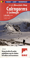
Wandelkaart Cairngorms and Lochnagar - Mountain Map | Harvey Maps
Water- en scheurvaste wandelkaart
€ 28,99
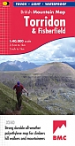
Wandelkaart Torridon & Fisherfield - Mountain Map | Harvey Maps
Water- en scheurvaste wandelkaart
€ 28,99
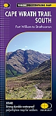
Wandelkaart Cape Wrath Trail South | Harvey Maps
Water- en scheurvaste wandelkaart
€ 25,99
Tijdelijk niet leverbaar
