- Gratis verzending vanaf 30 euro
- Levert in Nederland, België etc.
- Meer dan 30.000 titels
- Vakkundige klantenservice
- Snelle levering
- Veilig en eenvoudig betalen

Direct contact?
Bel +31 (0)6 42428571
maandag t/m vrijdag
van 10 tot 17 uur
Reisgids Brittany and Normandy Bretagne en Normandië Rough Guide

De Rough Guide is een zeer degelijke, uitgebreide en informatieve reisgids voor iedere type reiziger: van backpacker tot cultuurreiziger. De Rough Guide staat bekend om de degelijke en goed onderzochte achtergrondinformatie en de goede ordening van verschillende onderwerpen. Voor veel gebieden is de Rough Guide een goed, soms zelfs een beter, alternatief voor de populaire Lonely Planet. Practical travel guide to Brittany and Normandy with a free eBook featuring points-of-interest structured lists of all sights and off-the-beaten-track treasures, with detailed colour-coded maps, practical details about what to see and to do in Brittany and Normandy, how to get there and around, pre-departure information, as well as top time-saving tips, like a visual list of things not to miss in Brittany and Normandy, expert author picks and itineraries to help you plan your trip. The Rough Guide to Brittany and Normandy covers: Seine-Maritime; The Lower Normandy Coast; Inland Normandy; The North Coast and Rennes; Finistere; Inland Brittany: The Nantes-Brest Canal; The South Coast. Inside this travel guide you'll find:RECOMMENDATIONS FOR EVERY TYPE OF TRAVELLER Experiences selection for every kind of trip to Brittany and Normandy, from off-the-beaten-track adventures in Cote de Granit Rose to family activities in child-friendly places, like Etretat or chilled-out breaks in popular tourist areas, like Le Mont-Saint-Michel.
PRACTICAL TRAVEL TIPS Essential pre-departure information including Brittany and Normandy entry requirements, getting around, health information, travelling with children, sports and outdoor activities, food and drink, festivals, culture and etiquette, shopping, tips for travellers with disabilities and more. TIME-SAVING ITINERARIESCarefully planned routes covering the best of Brittany and Normandy give a taste of the richness and diversity of the destination, and have been created for different time frames or types of trip. DETAILED REGIONAL COVERAGEClear structure within each sightseeing chapter includes regional highlights, brief history, detailed sights and places ordered geographically, recommended restaurants, hotels, bars, clubs and major shops or entertainment options.
INSIGHTS INTO GETTING AROUND LIKE A LOCALTips on how to beat the crowds, save time and money and find the best local spots for exploring wild rugged coastlines, mighty medieval fortresses or sampling delicious variations of seafood and cheese. HIGHLIGHTS OF THINGS NOT TO MISSRough Guides' rundown of Rennes, Rouen, the Pays d'Auge and Finistere's best sights and top experiences help to make the most of each trip to Brittany and Normandy, even in a short time. HONEST AND INDEPENDENT REVIEWS Written by Rough Guides' expert authors with a trademark blend of humour, honesty and expertise, to help to find the best places in Brittany and Normandy, matching different needs.
BACKGROUND INFORMATIONComprehensive 'Contexts' chapter features fascinating insights into Brittany and Normandy, with coverage of history, religion, ethnic groups, environment, wildlife and books, plus a handy language section and glossary. FABULOUS FULL COLOUR PHOTOGRAPHYFeatures inspirational colour photography, including the stunning Mont St. Michel and the spectacular Honfleur.
COLOUR-CODED MAPPINGPractical full-colour maps, with clearly numbered, colour-coded keys for quick orientation in Nantes, St-Malo and many more locations in Brittany and Normandy, reduce need to go online. USER-FRIENDLY LAYOUT With helpful icons, and organised by neighbourhood to help you pick the best spots to spend your time. FREE EBOOK Free eBook download with every purchase of a printed book allows you to access all of the content from your phone or tablet, for on-the-road exploration.
Engelstalig
EAN: 9781839057908
Uitgeverij: Rough Guide
Verschijningsdatum: 2022
Meest recente editie
Engelstalig
408 pagina's

Op voorraad
Levertijd 2 dagen (Nederland)
- Vakkundige klantenservice
- Groot assortiment
- Gratis retourneren binnen 14 dagen
- Aangesloten bij WebwinkelKEUR
€ 21,99
Meer producten die interessant kunnen zijn
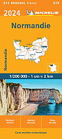
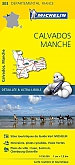
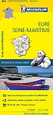
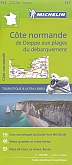
Wegenkaarten Normandië
Topografische kaarten Normandië

Topografische Wandelkaart van Frankrijk 2008OT - Dieppe / Eu / Forêt d'Arques
Carte de Randonnee | Wandelkaart | Institut Geographique National (IGN) Frankrijk
€ 16,90
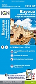
Topografische Wandelkaart van Frankrijk 1512OT - Bayeux / Arromanches-les-Bains / Plages du Débarquement
Carte de Randonnee | Wandelkaart | Institut Geographique National (IGN) Frankrijk
€ 16,90
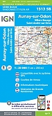
Topografische Wandelkaart van Frankrijk 1513SB - Aunay-sur-Odon / Villers-Bocage
Carte de Randonnee | Wandelkaart | Institut Geographique National (IGN) Frankrijk
€ 16,90
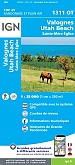
Topografische Wandelkaart van Frankrijk 1311OT Valoges - Ste-Mère-Eglise Utah Beach
Carte de Randonnee | Wandelkaart | Institut Geographique National (IGN) Frankrijk
€ 16,90
Historische kaarten Normandië
Wandelgidsen Normandië
Wandelgids 204 GR223 GR21 De la côte d'Albâtre aux plages du Bessin | FFRP Topoguides
GR 21 GR 223 | Ref. 204
€ 19,90
Wandelgids 200 GR223 Tour du Cotentin | FFRP Topoguides
Plus de 25 jours de randonnée d'Isigny-sur-Mer au Mont Saint-Michel.
€ 18,99
Tijdelijk niet leverbaar
Wandelgids 281 Normandie Rother Wanderführer | Rother Bergverlag
50 Wandelingen | Vom Mont-Saint-Michel bis zur Côte d Albâtre
€ 16,90
Fietsgidsen Normandië
Fietskaarten Normandië
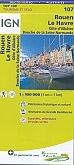
Fietskaart 107 Rouen Le Havre Côte d'Albâtre - IGN Top 100 - Tourisme et Velo
Cote d'Albatre Boucles de la Seine Normande - Water- en scheurvaste fietskaart
€ 10,50
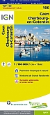
Fietskaart 106 Caen Cherbourg Octeville - IGN Top 100 - Tourisme et Velo
Water- en scheurvaste fietskaart
€ 10,50
Fietskaart 116 Laval Fougeres PNR Normandie Maine - IGN Top 100 - Tourisme et Velo
Water- en scheurvaste fietskaart
€ 10,50