- Gratis verzending vanaf 30 euro
- Levert in Nederland, België etc.
- Meer dan 30.000 titels
- Vakkundige klantenservice
- Snelle levering
- Veilig en eenvoudig betalen

Direct contact?
Bel +31 (0)6 42428571
maandag t/m vrijdag
van 10 tot 17 uur
Reisgids Slow Sussex and The South Downs Bradt Travel Guide

Straddling the Hampshire Downs and the distinctive countryside of Sussex, the South Downs is Britain's newest and most visited national park, and is abutted by a long coastline and the surprisingly remote landscapes of the Weald. Slow-travel enthusiast and Sussex resident Tim Locke takes a close-up look at the best of the countryside and places in his back yard, and celebrates what makes the area so distinctive. This is not a book of dry practicalities. Locke's local knowledge leads the reader to his favourite walks, pubs and and places to stay, while his colourful interviews with local craftsmen and characters give visitors a personal acquaintance with the region. Sussex boasts a huge variety of landscapes and architecture, from the chalk South Downs to the salty marshes at Chichester Harbour. The ways of enjoying it are just as diverse, and could include foraging for fungi on the Wealden heaths, watching the unique Sussex pastime of stoolball, paragliding over the Downs or sampling a locally produced wine.
Engelstalig
EAN: 9781784770426
Auteur(s): Tim locke
Uitgeverij: Bradt Travelguides
Verschijningsdatum: 2017
Meest recente editie
Engelstalig
296 pagina's
Op voorraad
Overmorgen in huis (Nederland)
- Vakkundige klantenservice
- Groot assortiment
- Gratis retourneren binnen 14 dagen
- Aangesloten bij WebwinkelKEUR
€ 17,99
Meer producten die interessant kunnen zijn
Wegenkaarten Zuid-Engeland


Wegenkaart - Landkaart Zuid-Engeland Wales - World Mapping Project (Reise Know-How)
Water- en scheurvaste wegenkaart
€ 11,25
Wandelgidsen Zuid-Engeland

Wandelgids 67 Downs South NP & East Sussex Pathfinder Guide
Pathfinder Guide 67 | Met Ordanance Survey kaarten
€ 17,99

Wandelgids 254 Zuid Engeland Süd | Rother
56 wandelingen Zwischen London, Dover, Jurassic Coast und Exmoor.
€ 14,90

Topografische kaarten Zuid-Engeland
Topografische Wandelkaart 182 Weston-super-Mare Bridgwater & Wells - Landranger Map
Wandelkaart & Fietskaart | Ordnance Survey (OS) Groot-Brittannië
€ 18,99

Topografische Wandelkaart OL15 van Groot-Brittannië (1:25.000) Purbeck / South Dorset - Explorer Map OL 15
Wandelkaart | Ordnance Survey (OS) Groot-Brittannië
€ 18,99
Topografische Wandelkaart 141 Cheddar Gorge / Mendip Hills West - Explorer Map
Wandelkaart & Fietskaart | Ordnance Survey (OS) Groot-Brittannië
€ 18,99

Topografische Wandelkaart 155 Bristol / Bath - Explorer Map
Wandelkaart & Fietskaart | Ordnance Survey (OS) Groot-Brittannië
€ 18,99
Wandelkaarten Zuid-Engeland
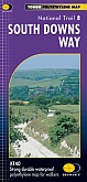
Wandelkaart South Downs Way - National Trail Maps | Harvey Maps
Water- en scheurvaste wandelkaart
€ 25,99
Fietskaarten Zuid-Engeland

Fietsgidsen Zuid-Engeland
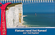
Fietsgids Fietsen rond het Kanaal deel 1 | Recreatief Fietsen
van Dover of Harwich naar Plymouth incl. de kanaaleilanden 700 km Spiraalband 21 x 14 cm
€ 21,50